- Offline maps eliminate dependence on cellular data, ensuring you are never stranded without navigation in foreign cities.
- Pre-downloading map areas before leaving your accommodation saves battery life and avoids roaming charges.
- Strategic planning—such as marking your hotel and transport hubs—provides a vital safety net for independent exploration.
For many travelers aged 60 to 80, the joy of city exploration lies in the freedom to wander at one’s own pace. However, the anxiety of losing one’s way or the frustration of unreliable mobile data can hinder that experience. Digital offline maps have emerged as the most reliable tool for maintaining independence and safety while traveling abroad. By downloading map data directly to your device before you step out, you ensure that you have a constant, battery-efficient, and data-free navigation companion in your pocket.
Why Offline Maps Are Essential for Senior Travelers
Navigation is the backbone of travel confidence. When you rely solely on streaming data, you are vulnerable to “dead zones,” unpredictable roaming fees, and rapid battery depletion. Offline maps function by storing geographical data, street names, and points of interest locally on your smartphone’s internal storage.
The primary advantage is reliability. In historic city centers with thick stone walls or remote areas with weak cellular reception, your GPS signal (which works independently of cellular data) will still pinpoint your location on the downloaded map. This means you do not need a Wi-Fi connection to find your way back to your hotel or locate the nearest accessible public restroom.
Reducing Cognitive Load and Travel Anxiety
Travel in a foreign country involves a significant amount of sensory processing. Trying to manage paper maps, which can be cumbersome and difficult to read in changing light, adds unnecessary stress. A digital map allows you to zoom in on specific intersections, adjust font sizes for better visibility, and even switch to high-contrast modes. By removing the “will I get lost?” variable from your travel experience, you can devote your energy to enjoying the culture, architecture, and cuisine of your destination.
Choosing the Right Application for Your Needs
Not all map applications are created equal. When selecting an app for international travel, consider the following criteria: ease of use, the ability to download large areas, and the clarity of the interface.
| Feature | Google Maps | Maps.me / Organic Maps |
|---|---|---|
| Best For | Detailed business info and reviews. | Pure offline navigation and battery efficiency. |
| Offline Capability | Downloadable areas (limited time). | Entire countries or regions indefinitely. |
| Ease of Use | Highly intuitive, familiar interface. | Minimalist, occasionally complex UI. |
For most travelers, Google Maps is the standard due to its integration with public transport data. However, if you are planning a trip to a region with limited internet access, Organic Maps is an excellent open-source alternative that is lightweight and highly optimized for offline use.
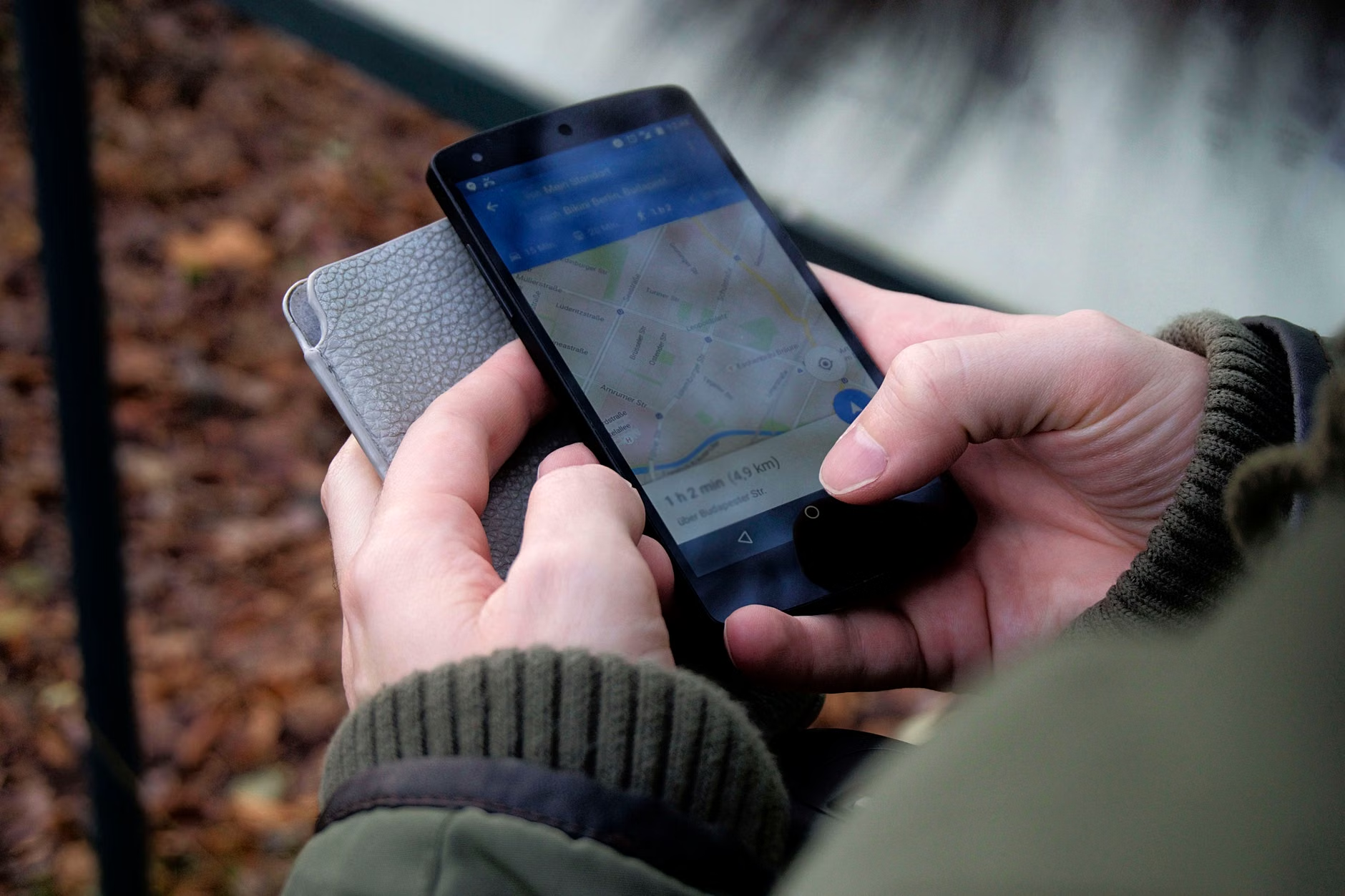
Step-by-Step: Setting Up Your Offline Maps Before Departure
Preparation is the most critical step. Do not wait until you arrive at your destination to download your maps. Follow this checklist to ensure your device is ready for your journey.
1. Clear Your Storage
Offline maps require storage space. Before your trip, delete unnecessary photos, videos, or unused apps to ensure you have at least 2-3 gigabytes of free space. This prevents the “storage full” error when you are attempting to download a major city map.
2. Download While on Stable Wi-Fi
Downloading high-resolution maps can be data-intensive. Use your hotel or home Wi-Fi to download the necessary regions. If you are visiting multiple cities, download each one separately to manage space effectively.
3. Mark Your Vital Locations
Once the map is downloaded, pin your “home base”—your hotel or rental apartment. By starring this location, you can always tap “Directions” from anywhere in the city, and the app will guide you back to your starting point without needing a live internet connection.
4. Verify Your Settings
Go into the app settings and ensure that “Offline Maps” is set to update automatically over Wi-Fi. This ensures that if you are staying in a city for an extended period, the map data remains current with any recent road changes or permanent closures.
For travelers who prioritize safety and accessibility, maps offer more than just a route from A to B. They can be used to identify potential obstacles before you encounter them.
Identifying Accessible Routes
Many modern navigation apps now include features to show wheelchair-accessible routes or paths with fewer stairs. If you are traveling with a mobility aid or simply prefer flatter terrain, take the time to inspect the route on your map. Look for “Step-free” indicators or paths that follow main thoroughfares rather than narrow, cobblestoned alleys which may be difficult to navigate.
Locating Essential Facilities
Offline maps are invaluable for locating public restrooms, pharmacies, and seating areas. Before heading out for a walk, scan your map for parks or public squares. These locations almost always provide benches where you can rest, hydrate, and re-orient yourself without feeling pressured by the pace of the city.

The Role of Battery Management and Hardware
Digital navigation is the most battery-intensive task your smartphone performs. GPS tracking requires constant communication with satellites, and the screen must remain bright enough to read in daylight. To ensure your device lasts the entire day:
- Use a Portable Power Bank: Always carry a lightweight, high-capacity power bank. A 10,000mAh battery is usually sufficient for two full charges of most smartphones.
- Adjust Screen Brightness: Reduce screen brightness to the lowest level that is still comfortable. High brightness is the number one cause of rapid battery drain.
- Turn Off Background Apps: Close apps that track your location in the background (like social media or fitness trackers) to save energy for your navigation tool.
Common Mistakes to Avoid
Even experienced travelers make mistakes when relying on digital tools. The most common error is over-reliance on the “blue dot.” GPS can sometimes be slightly inaccurate in areas with high-rise buildings (the “urban canyon” effect). If the blue dot seems to be jumping around, look for landmarks—a specific building, a statue, or a street sign—to confirm your actual position.
Another mistake is failing to account for local transport nuances. Offline maps may show you the route, but they cannot tell you if a specific station has a functioning elevator. Always cross-reference your route with the official transit authority website for the city you are visiting. In many major global cities, such as London or New York, the transit authority provides specific “accessibility maps” that show which stations are equipped with lifts.

Advanced Tips for Independent Exploration
Once you are comfortable with the basics, you can use offline maps to create a more personalized experience. Use the “Add Label” or “Custom List” feature to create your own itinerary. By pinning museums, cafes, and shops you wish to visit, you can see how they are clustered together geographically. This allows you to group your visits by neighborhood, significantly reducing the amount of transit time and physical exertion required.
Furthermore, consider the “Walk and Reset” method. Instead of walking for hours, walk for 30 minutes, find a cafe or park, open your offline map, and assess your next move. This pacing strategy ensures you remain within your stamina limits while keeping a clear view of your surroundings.
Refining Your Approach to Global Travel
Every country has its own digital infrastructure. In Japan, for example, train stations are massive, multi-level complexes where a standard map might be confusing. In such cases, downloading a specific “Indoor Map” or looking for station-specific guides is highly recommended. In smaller European towns, the challenge is often narrow, winding streets that may not be fully mapped. In these instances, the best strategy is to use the map for general orientation and rely on local signage for the final turn.
Remember that technology is a tool to support your journey, not to dictate it. If you find yourself in a beautiful area that isn’t on your pre-planned route, take the time to explore it. Your offline map will always be there to help you find your way back when you are ready.
Conclusion: Empowerment Through Digital Literacy
Mastering offline maps is one of the most effective ways to enhance your travel experience. It provides the security of knowing where you are, the flexibility to change plans on the fly, and the confidence to explore beyond the tourist hubs. By preparing your device before you leave, managing your battery usage, and prioritizing your physical comfort, you turn your smartphone into an indispensable travel partner. Embrace this digital capability not as a chore, but as a gateway to more independent and adventurous travel in your golden years.
Frequently Asked Questions (FAQ)
1. Do I need a cellular data plan to use offline maps?
No. Once the map data is downloaded to your device while on Wi-Fi, you do not need any cellular data or internet connection to navigate. The GPS chip in your phone works independently of mobile networks, allowing your position to be shown on the map anywhere in the world.
2. How much storage space do I need on my phone?
It depends on the size of the area you are downloading. Generally, a major city map requires between 50MB and 200MB. A small country or a large region could take up to 1GB. Always aim to have at least 2GB to 3GB of free space before your trip to ensure you have room for additional maps if your plans change.
3. What should I do if my phone battery dies while I am out?
The best practice is to carry a portable power bank. However, if your battery does die, look for public transportation hubs or large hotels, which often have maps in their lobbies. Additionally, it is always a good idea to carry a small, physical “emergency card” in your wallet with the address of your accommodation written in the local language, which you can show to a taxi driver or a local for assistance.
For further reading on travel safety and accessibility, visit official resources such as the World Health Organization’s Age-Friendly World initiative, which provides insights into creating and navigating accessible urban spaces.
Navigating global cities requires an understanding of how local urban planning affects GPS accuracy and map reliability. In cities like Venice, Italy, the “urban canyon” effect is replaced by the “labyrinth effect.” GPS signals can bounce off water and narrow stone corridors, leading to temporary inaccuracies. In these environments, the best practice is to use your offline map to identify the general direction of your destination—for example, “heading towards the Rialto Bridge”—rather than relying on the device for turn-by-turn precision. Use the map to confirm you are in the correct district, then rely on the abundant local directional signage to reach your specific destination.
Contrast this with a city like Singapore or Tokyo, where the challenge is verticality. You may be at the correct latitude and longitude, but you might be on the wrong floor of a massive transit hub. In these scenarios, look for “indoor navigation” features within your map app, or specifically search for “station maps” on the local transit authority’s website. These maps are often far more detailed than general-purpose navigation apps and are crucial for seniors who wish to avoid unnecessary stair climbing or long walks between platforms.
Decision-Making Framework for Daily Exploration
How do you decide between a walking route and a public transit route when you are tired? Use this simple decision rule: The 20-Minute Rule. If your offline map indicates that the walking distance is under 20 minutes (roughly 1.5 kilometers or 1 mile for a moderate pace), you are usually better off walking. This avoids the complexity of navigating public transit systems, which often involve long walks to station entrances, multiple levels, and wait times. If the distance is over 20 minutes, prioritize public transit, but use your map to check the walking distance to the nearest stop. If the walk to the stop is more than 10 minutes, consider a taxi or ride-share service. Using your map to calculate these distances in advance allows you to make informed decisions that conserve your energy for the activities you truly enjoy.
A common misconception is that offline maps are only for “tech-savvy” individuals. In reality, the interface of modern map applications is designed for mass use. The barrier is not technical capability but rather the lack of a structured approach. By treating your map as a static guide—similar to a paper map that simply happens to show your current location—you remove the pressure to “learn” the technology. You do not need to know how to use advanced features like layers, traffic overlays, or public transit routing if you find them overwhelming. Simply knowing how to download the area and tap the “Start” button for directions is sufficient to navigate 95% of the world’s major travel destinations.
Another misconception is that offline maps are “outdated.” While it is true that they do not show real-time traffic jams or temporary road closures, this is rarely a concern for a tourist walking or taking public transit. In fact, the lack of real-time data is a benefit: it prevents the app from constantly trying to “re-calculate” your route, which saves battery and prevents the confusion of a map that is constantly changing while you are trying to read it.
The Importance of Physical Backups
While digital maps are superior for navigation, they should not be your only tool. A “hybrid” approach is the gold standard for senior travelers. Carry a small, printed card with the address of your hotel in the local language. If your phone is lost, stolen, or runs out of battery, you can hand this card to a taxi driver or ask a local for help. This simple, low-tech backup is the best insurance policy for any trip. Additionally, keeping a paper map of the city center—often available for free at hotel front desks—can be a helpful way to visualize the “big picture” of a city that a small phone screen cannot provide.
By integrating digital precision with analog safety nets, you create a robust navigation strategy that allows you to explore with complete peace of mind. Remember, the goal of travel is the experience itself; digital tools are merely the invisible support system that allows you to reach those experiences safely and efficiently.
(Note: As you continue your travels, revisit your offline map settings periodically. Technology evolves, and new features—such as improved accessibility filters—are added regularly. Staying informed about these updates ensures your travel toolkit remains as effective as possible.)