Key Takeaways
- Reliability: Offline maps eliminate dependence on unstable cellular data or public Wi-Fi, ensuring you always have a way to find your hotel or a transport hub.
- Battery Management: Using offline maps significantly reduces battery consumption by eliminating the need for constant data roaming and GPS triangulation with cellular towers.
- Strategic Planning: Downloading maps while at your accommodation allows you to pin essential locations like public toilets, pharmacies, and subway entrances before you step out.
Introduction: The Freedom of Digital Self-Reliance
For the independent traveler, the ability to navigate a new city without anxiety is the cornerstone of a successful trip. While many rely on live mobile data, seasoned travelers know that connectivity is often the first thing to fail. Whether you are navigating a labyrinthine historic district in Europe or searching for a specific bus stop in a sprawling Asian metropolis, relying on a stable internet connection can lead to frustration and unnecessary stress.
Offline maps offer a robust solution. By downloading map data directly to your smartphone, you create a fail-safe navigation tool that functions anywhere in the world, regardless of cellular reception. For older adults, this technology represents more than just convenience; it is a vital tool for maintaining autonomy, safety, and confidence while exploring unfamiliar environments.
Why Offline Maps are Essential for Mature Travelers
Navigation is not just about finding a destination; it is about managing your energy, time, and safety. When you are traveling, every wrong turn adds physical strain and mental fatigue. Offline maps mitigate these risks by providing precise, real-time location tracking using only your phone’s internal GPS chip, which does not require a data plan.
The Connectivity Challenge
In many regions, public Wi-Fi is unreliable, and roaming charges can be exorbitant. Furthermore, cellular signal strength can fluctuate wildly in narrow alleyways, tunnels, or mountainous regions. Offline maps ensure that your navigation tool remains active even when you are “off the grid.”
Battery Preservation
One of the most significant advantages of offline navigation is battery efficiency. When a phone constantly searches for a 4G or 5G signal, it drains power rapidly. By switching your phone to “Airplane Mode” and relying on downloaded maps, you can extend your device’s battery life by several hours, ensuring you have enough power for emergencies or capturing photos throughout the day.
Selecting the Right Tools for Your Needs
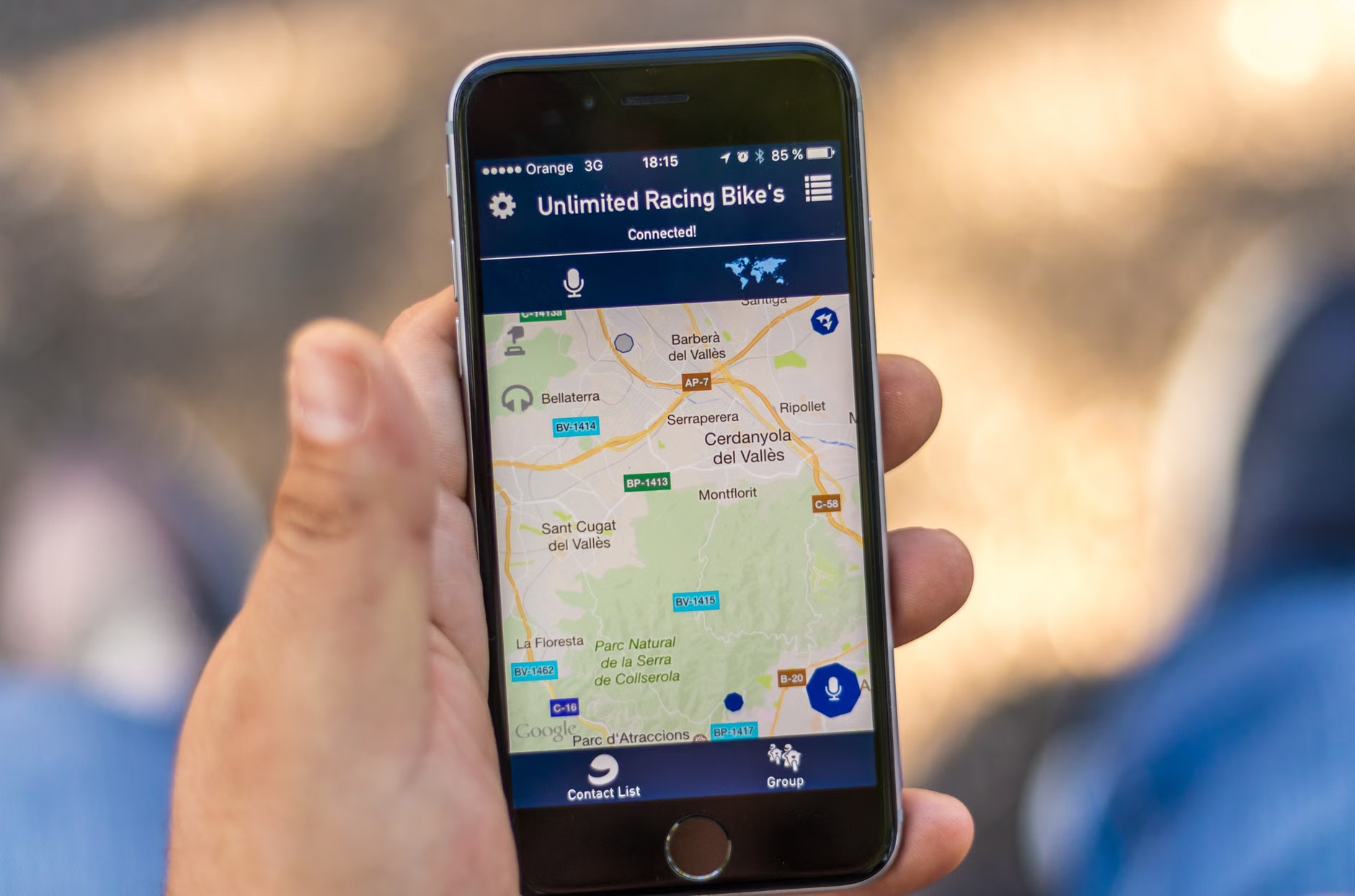
Not all map applications are created equal. When choosing an application, consider the user interface, the ease of downloading, and the level of detail provided regarding pedestrian-friendly routes.
| Feature | Google Maps | Maps.me | Apple Maps |
|---|---|---|---|
| Offline Capability | Excellent (area-based) | Excellent (country/region) | Limited (region-based) |
| Ease of Use | Very Intuitive | Moderate | Highly Intuitive |
| Detail/POI | High (incl. businesses) | Medium (focus on trails) | High (clean design) |
| Battery Impact | Low (if offline) | Very Low | Low |
For most travelers, Google Maps is the standard due to its wealth of information regarding business hours and public transport. However, Maps.me is often preferred by those who want to download massive, high-detail regions (like an entire country) in one go, which is useful for longer trips.
Step-by-Step: Setting Up for Success
Preparation is the key to a stress-free experience. Do not wait until you are standing on a street corner to figure out your technology.
1. Pre-Trip Preparation
Before you leave your home or hotel, ensure you have sufficient storage space on your device. Download maps for the entire metropolitan area or region you plan to visit. It is better to download too much than too little.
2. Pinning Essential Locations
Before you head out, use the “Save” or “Pin” feature to mark:
- Your accommodation: This is your base and your safety net.
- Public transport hubs: Train stations and bus terminals.
- Essential services: Nearby hospitals, pharmacies, and public restrooms.
- Emergency points: The nearest embassy or police station.

Standard navigation apps often prioritize the “fastest” route, which may involve steep hills, long staircases, or cobblestone streets that are difficult for those with mobility aids or joint sensitivity. While digital maps cannot always identify every single curb, you can use the “Street View” function to inspect a route before you commit to it.
The “Look Before You Walk” Technique
Before leaving your hotel, zoom in on your planned route. Use the satellite view to identify if a path looks particularly narrow or congested. If you are using a walker or cane, prioritize main roads which often have better-maintained sidewalks compared to narrow, historic side streets.
Managing Stamina
Independent travel should be a joy, not an endurance test. If your map shows a destination is a 20-minute walk away, be honest about your current energy levels. Use your navigation app to find a nearby café or park bench midway. Breaking a long walk into 10-minute segments with a planned rest period is a proven strategy to maintain stamina throughout the day.
Safety and Digital Security
While technology is a great aid, it should never replace your situational awareness. When using your phone to navigate, keep your head up and scan your surroundings. It is a common mistake to become so absorbed in the screen that you lose track of traffic or your personal belongings.
The Backup Plan
Always carry a physical, paper map or a business card from your hotel. Technology can fail—batteries can die, and devices can be dropped. A simple physical map is a reliable backup that requires no power. Furthermore, having the address of your hotel written in the local language is a lifesaver if you need to ask a local or a taxi driver for help.

Advanced Tips for the Tech-Savvy Senior
For those who are comfortable with technology, consider these advanced strategies to enhance your trip:
- Create Custom Lists: Build a “To-Visit” list in your map app categorized by day or by interest (e.g., “Museums,” “Dining,” “Parks”). This keeps your map interface clean and prevents decision fatigue.
- Use Voice Guidance: If you find reading a small screen while walking difficult, use a single earbud to listen to turn-by-turn directions. This allows you to keep your eyes on the road and your surroundings.
- Download Transit Schedules: In many cities, you can download public transit maps as PDFs. These can be opened in your phone’s file manager even without an internet connection.
Common Mistakes to Avoid
The most frequent error is assuming that “Offline” means “Everything is available.” While the map data is saved, real-time traffic updates and live public transport schedules will not work offline. Always check the departure times for the last bus or train of the day while you are still at your hotel and have a Wi-Fi connection.
Another common mistake is failing to update your maps. If you downloaded a map six months ago, local road closures or construction might not be reflected. Refresh your offline map data 24 hours before your departure.
Conclusion: Confidence Through Preparation
Independent travel at 60, 70, or 80 is an incredibly rewarding experience. It keeps the mind sharp and the spirit adventurous. By mastering the use of offline maps, you remove one of the greatest barriers to independent exploration: the fear of getting lost or being disconnected. With a little bit of pre-trip preparation and a solid understanding of your digital tools, you can navigate the world with the confidence of a local, ensuring your focus remains on the beauty and culture around you rather than the logistics of getting there.
Remember, your smartphone is a tool for your benefit, not a master to be obeyed. If your map leads you to a steep hill you don’t feel like tackling, trust your instincts and find an alternative route. Your comfort and safety are always the priority. Happy travels!
Frequently Asked Questions
1. Do I need a data plan if I use offline maps?
No, you do not need an active data plan for the navigation to function once the maps are downloaded. Your phone’s GPS chip works independently of cellular data. However, you will need a Wi-Fi connection to download the map files initially.
2. How much storage space do offline maps take up?
It depends on the size of the area. A city-sized map usually takes up between 50MB and 200MB. Most modern smartphones have more than enough space to store maps for several large cities or even an entire small country.
3. Will I lose my location if I lose my GPS signal?
While it is rare to lose a GPS signal in open environments, it can happen in deep valleys, tunnels, or inside massive stone buildings. If your blue dot disappears, look for street signs or landmarks and compare them to your map to re-orient yourself. This is why having a physical, paper map is always recommended as a backup.
For further reading on travel safety and accessibility, visit the official World Health Organization (WHO) Age-friendly World portal for tips on maintaining mobility in urban environments.